The course is split into three loops that start and end at Kimberley Alpine Resort. The trails and amazing, and the climbs are daunting. There isn't a single bit of pavement on the course, and you get many kilometres of technical single track. 54k solos have 12 hours to finish. 108k solos and teams have 24 hours and repeat the same loop. Don't like loop courses? Wait until you see these trails before you say that! Each leg is run counter-clockwise.
Use and enjoy at your own risk! The course is not marked except for race weekend.
– Black Spur GPX full course (one loop)
– Leg 1 + 4 only
– Leg 2 + 5 only
– Leg 3 + 6 only
NEW!
Try the course on RunGo. This app allows you to download the course and gives you voice prompts for turns if you get the paid subscription. NOTE: This is still in BETA testing so use at your own risk. The routes are correct, but the turn prompts may be missing out out of date due to trail changes.
– RunGo Leg 1/4
– RunGo Leg 2/5
– RunGo Leg 3/6
Distance: 54km / 108km
Gain/Loss: 2,230m / 2,230m (54k) – 4,460/4,460 (108k)
Duration: 12h (54k) – 24h (100k)
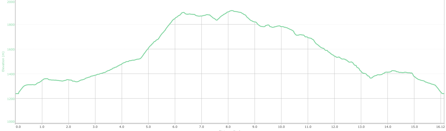
Distance: 16.1km
Gain/Loss: 886m/886m
Max Elev: 1,912m
GOAT starts off with wide open trails that let racers jockey for position, then you're suddenly on single track and starting to climb into some of the gnarliest terrain on the back of North Star Hill. You summit North Star and begin a screaming, technical descent back to the resort.
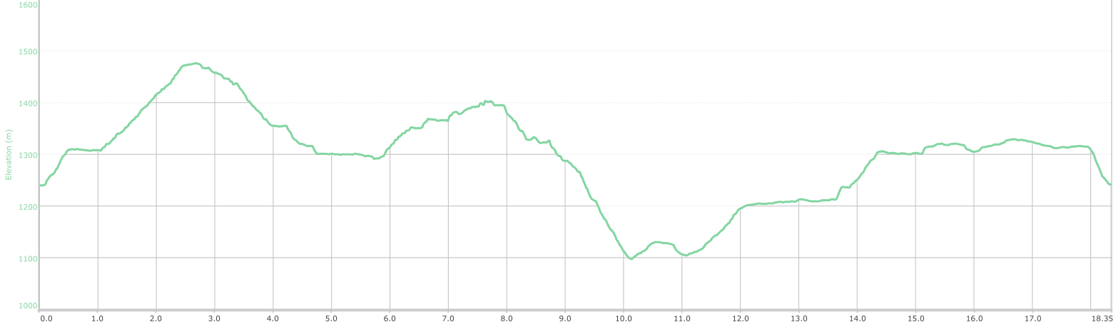
Distance: 18.3km
Gain/Loss: 674m/674m
Max Elev: 1,476m
TOAD takes you through lush valleys, wild rockslide gullies, and dark forest. This leg is all up and down, all the time, with some of the twistiest trails and best views in the area.
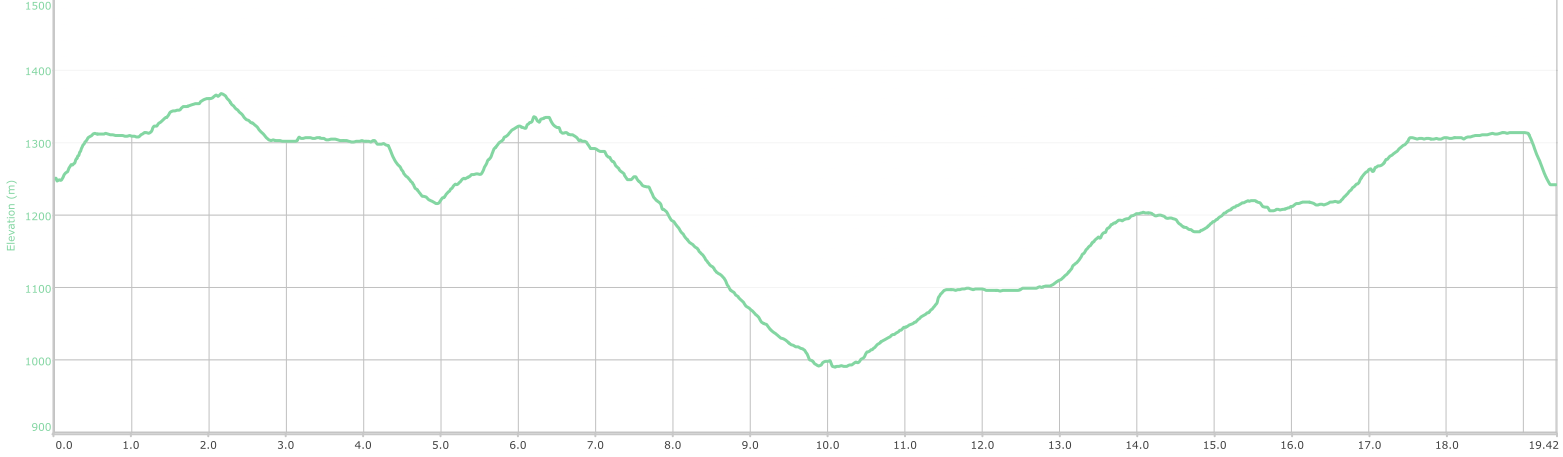
Distance: 19.4km
Gain/Loss: 670m/670m
Max Elev: 1,368m
BEAR takes you almost all of the way to St. Mary's River and the lowest point on the course. That means you also get to climb all the way back up! You get to climb over the side of Myrtle Mountain and enjoy some of the most open vistas in almost savannah-like terrain.


©2020-2023 Sinister Sports Inc. All Rights Reserved.


